Maps
Historically, maps of South Australia have been produced for numerous reasons, for the Department of Agriculture and for industry.
Commonwealth Statistics Map
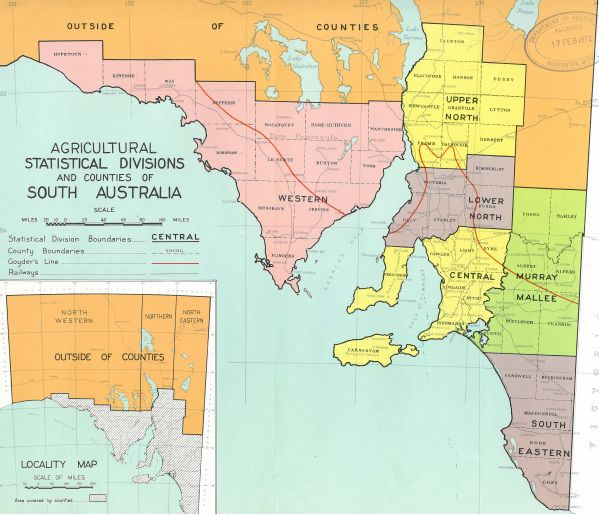
The Commonwealth Statistics Map () is a picture of the common statistical boundaries used in compiling agricultural statistics over many years. It breaks the state into six zones based on the original surveyed counties, plus an area in the north that was not zoned. These counties are further divided into hundreds and sections as the basis for land subdivision.
Statistics were compiled from hundreds and then amalgamated into counties, and then statistical divisions, and ultimately statewide statistics.
Prior to Federation, each state published extensive statistical information. Afterwards, the Australian Bureau of Statistics (ABS) produced publications on individual sectors and a comprehensive publication of state agricultural production statistics. Today these have been contracted into national ABS publications.
Land Utilization Zones
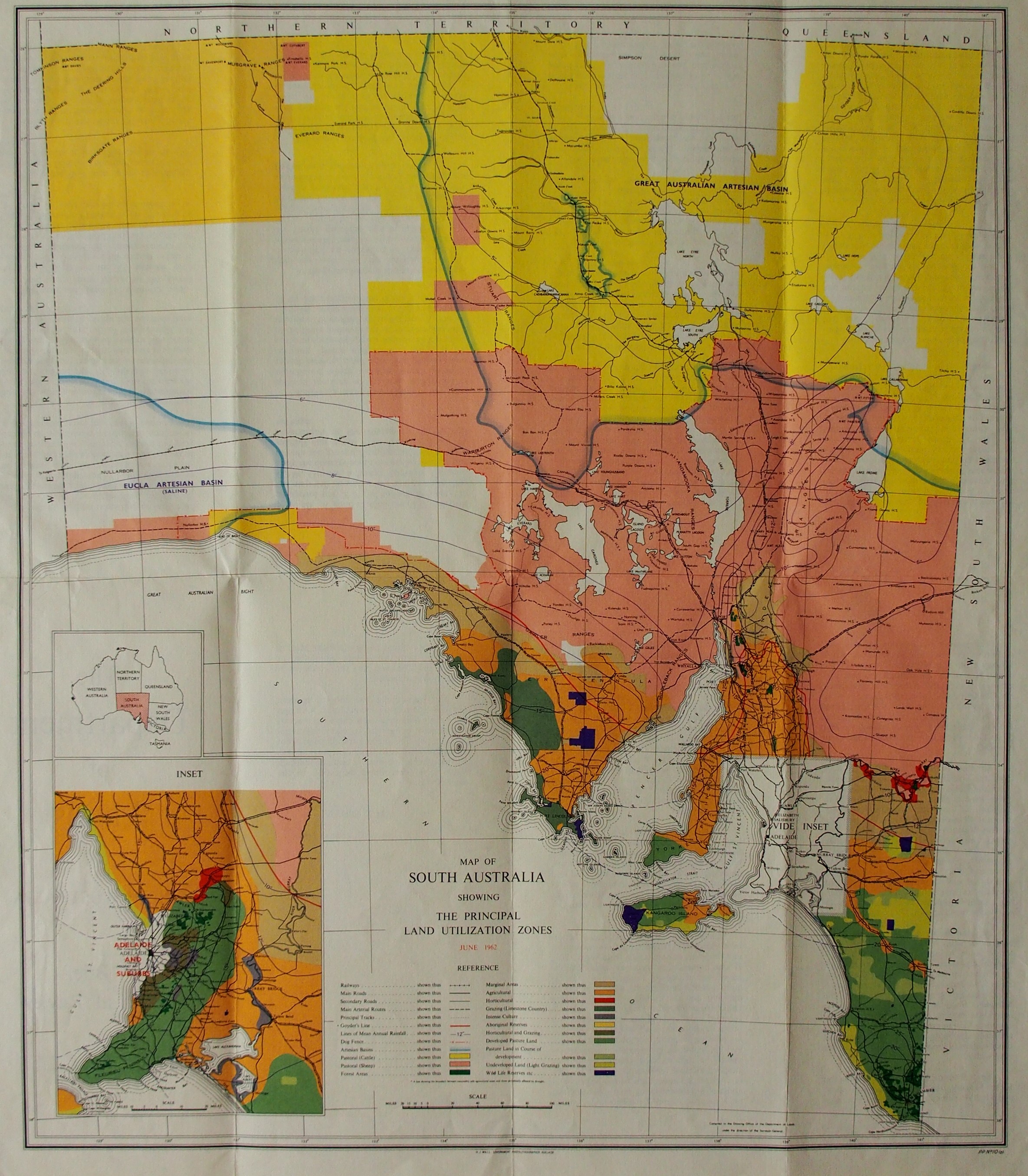
The Land Utilization Zones map (), produced by the Department of Lands, outlines the Principal Land Use Zones of South Australia. Published June 1962.
Subdivision of Nalang Estate
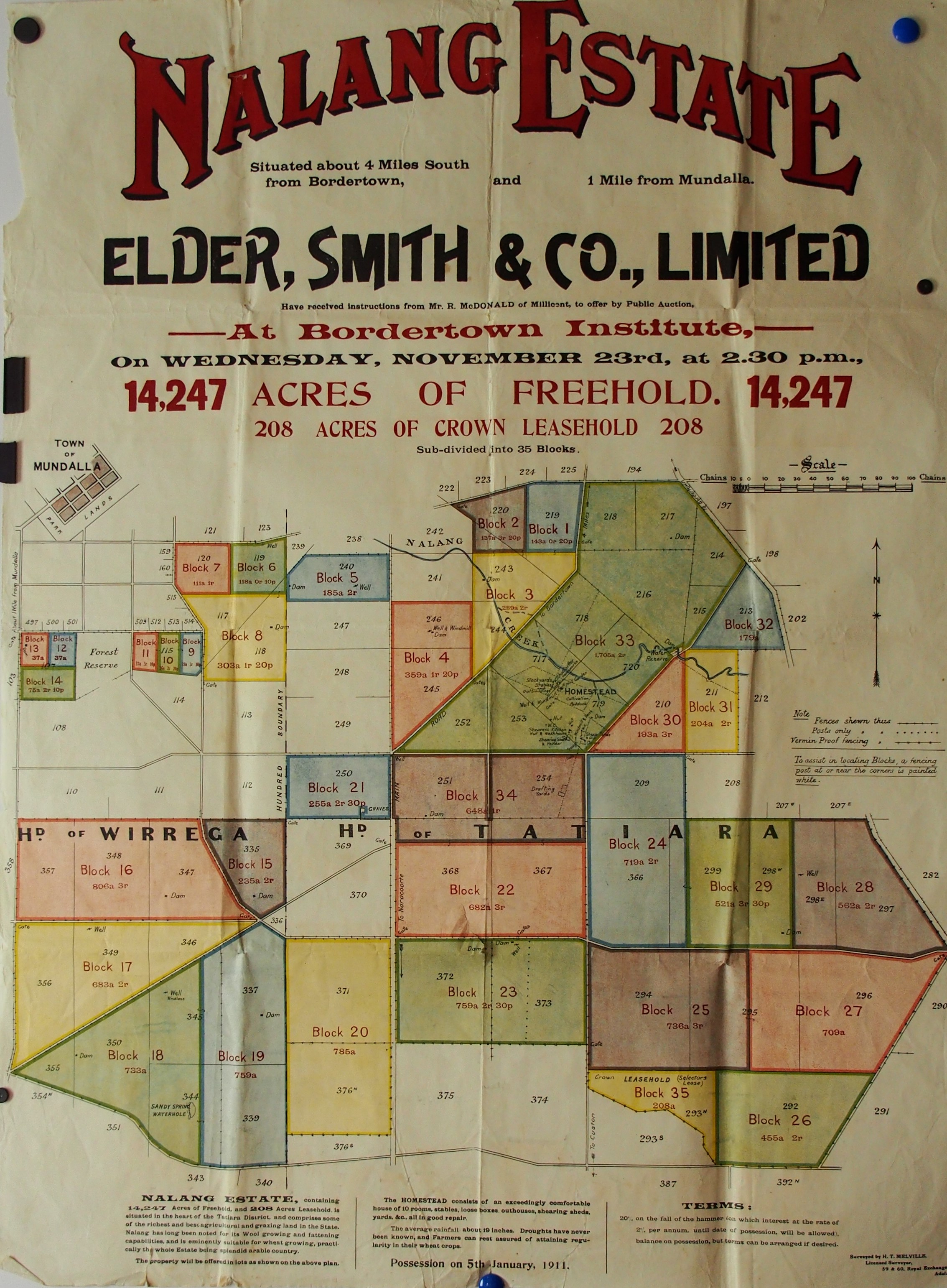
The subdivision of Nalang Estate poster () publicises the sale of rural blocks following the subdivision on the outskirts of Mundulla, in 1911. It reflects a period of closer settlement at the time.
Land subdivision at Lowan Vale
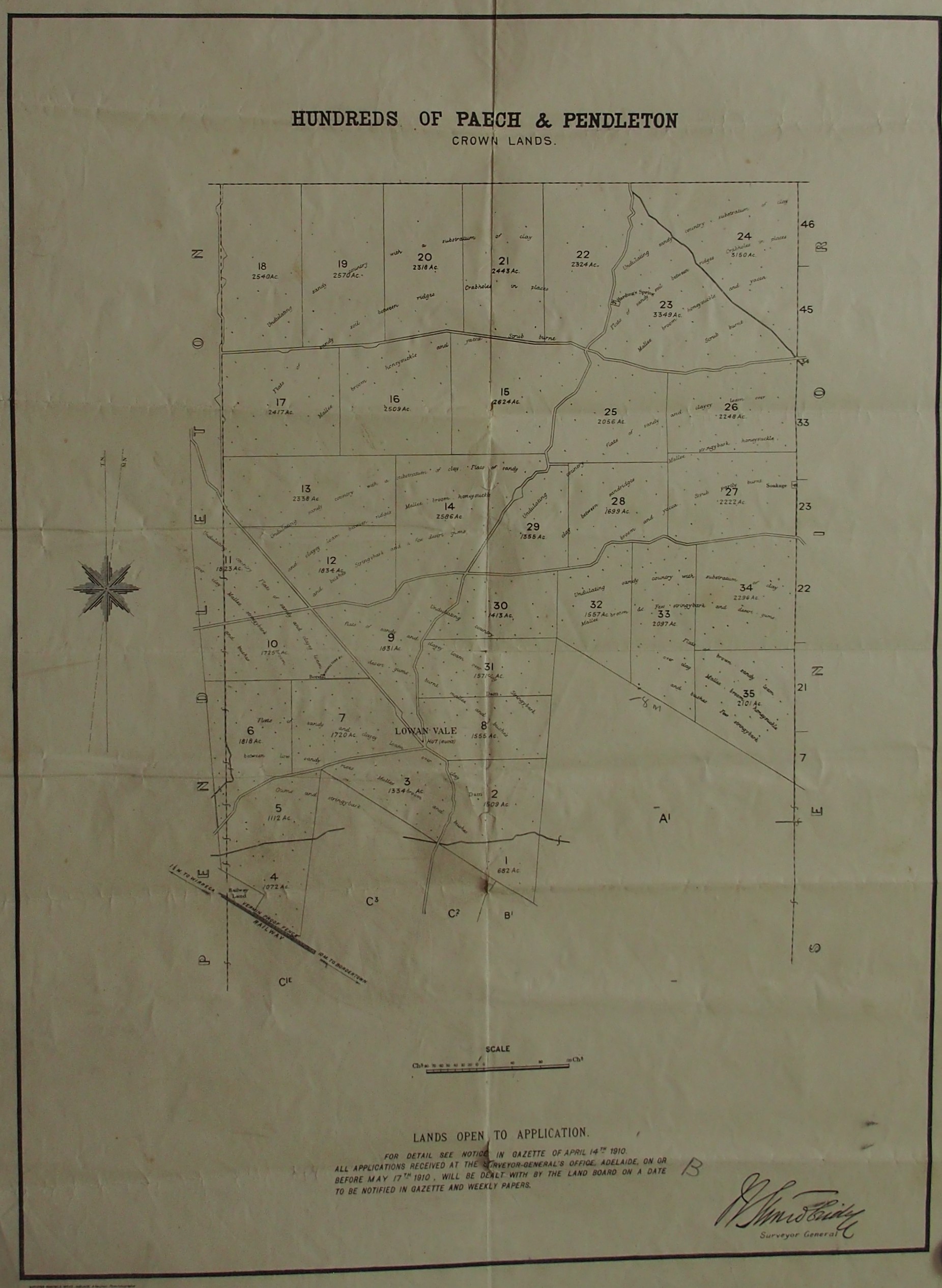
In 1910 a parcel of Crown Lands in the Hundreds of Paech and Pendleton was open to application, following land subdivision at Lowan Vale (). It is to the north of the road between Keith and Bordertown and was part of the Government's agricultural development policy.
North Booborowie Estate
The North Booborowie Estate () was subdivided for closer settlement in 1911. The objective was to create smaller land holdings for intensive production. Part of this subdivision was the provision of two blocks of land for the establishment of the Booboorowie Experimental Farm.