Download closure maps for GPS and Google Maps
GPS (global positioning system), Google Earth, and Google Maps files have been created to show aquatic reserves and Rock Lobster sanctuaries.
Please read the disclaimers and accuracy statement before downloading the data.
To access the different file types, you will need to:
- download Google Earth to use KMZ files
- use a compatible GPS device for GPS files – refer to the device manufacturer for instructions on using GPS files
- use a browser for Google Maps files.
Aquatic reserves
Rock lobster sanctuaries
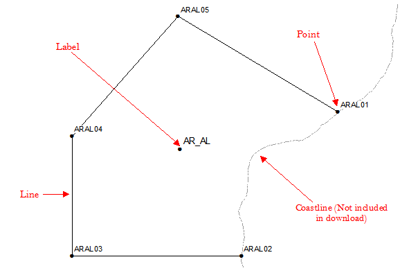
GPS data components
The GPS locations have been broken down into components to make them compatible with most devices. Data can be downloaded as:
- lines – outlining the boundaries of the zone, excluding the coast
- points – the legally defined coordinates of the boundaries
- labels – waypoints that have been based on the centroid position.
Examples