GPS and Google Earth downloads for aquatic reserves
GPS, Google Earth, and Google Maps files have been created to show aquatic reserves and Rock Lobster sanctuaries.
Using the files on this page
- You will need to download Google Earth to use KMZ files.
- You will need a compatible GPS device to use GPS files. Refer to the GPS manufacturer for instructions on using GPS files.
- Google Maps files are viewed in your browser.
Aquatic reserves
Rock lobster sanctuaries
GPS data
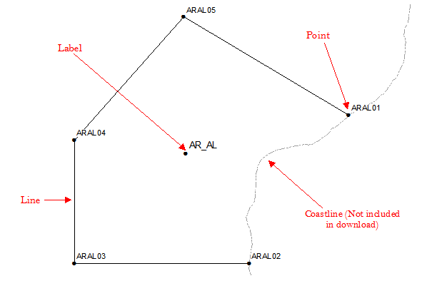
The GPS locations have been broken down into different components to make them compatible with most GPS devices.
Data can be downloaded as:
- Lines: outlining the boundaries of the zone, excluding the coast.
- Points: the legally defined coordinates of the boundaries.
- Labels: these are waypoints that have been based on the centroid position.
Example of each component:
More information
- Please read the disclaimers and accuracy statement before downloading the data.
- Marine park zones GPS coordinates are available on the National Parks South Australia website.
Page last reviewed: 16 May 2019