
Water management imagery – Agronomeye, Digital twin
The Digital twin is a high resolution, full farm 3D model with detailed elevation data. It can be used for a range of management decisions, particularly related to water use efficiency.
Benefits
Elevation within the paddock can affect the flow of water for growing crops, subsequently reducing crop performance.
The Agronomeye information allows you to recognise problem areas and optimise your water management.
How it works
Lidar scanning maps your property and captures all visible details for analysis by the Agronomeye team. Water flow is tracked across the farm to:
- determine catchment location
- identify erosion risks and water logging.
Information is accessed on your computer through a web app, displaying an aerial view of the land and on-farm water. You can review, measure, report, and share the data to improve farm management.
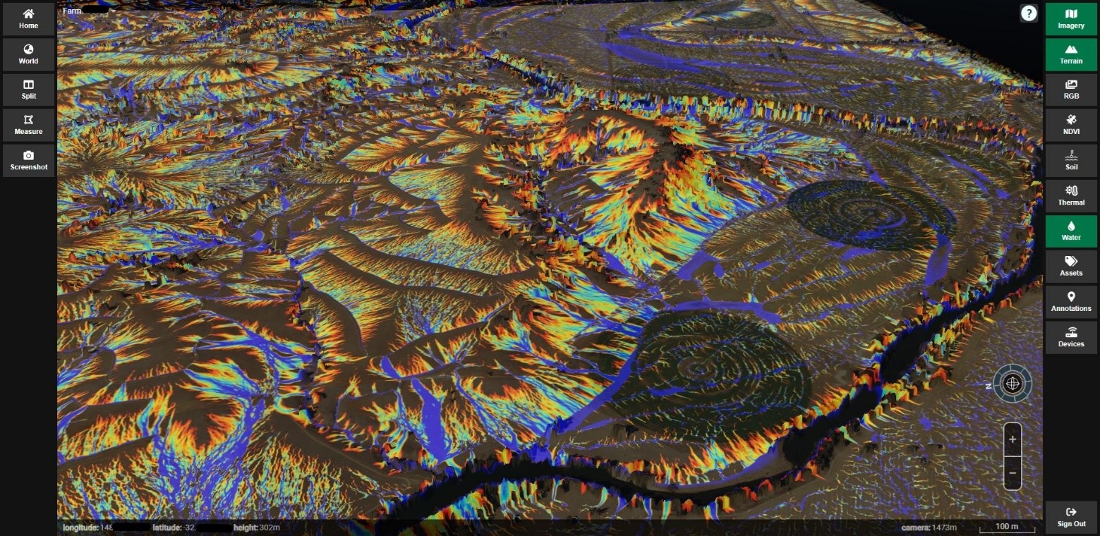 Agronomeye data showing the water flow mapped for Struan demonstration farm
Installation and power
Through a network of manned aircraft, the data is captured and uploaded to the Agronomeye platform remotely by the analytics team.
Connectivity requirements
No in-field connectivity is required.
Pricing model
Upfront fee with ongoing subscription after the first 12 months.
See it in action
To view the Digital twin technology, contact the AgTech Extension Officer at Struan and Kybybolite demonstration farm.
Contact vendor
Stu Adam – Agronomeye
Email: stu@agronomeye.com.au
Phone: 0421 874 771