
Water management imagery – Ceres Imaging
Ceres Imaging captures high-resolution aerial images to deliver irrigation management solutions.
 Benefits
Ceres Imaging helps crop growers to improve productivity through actionable data insights.
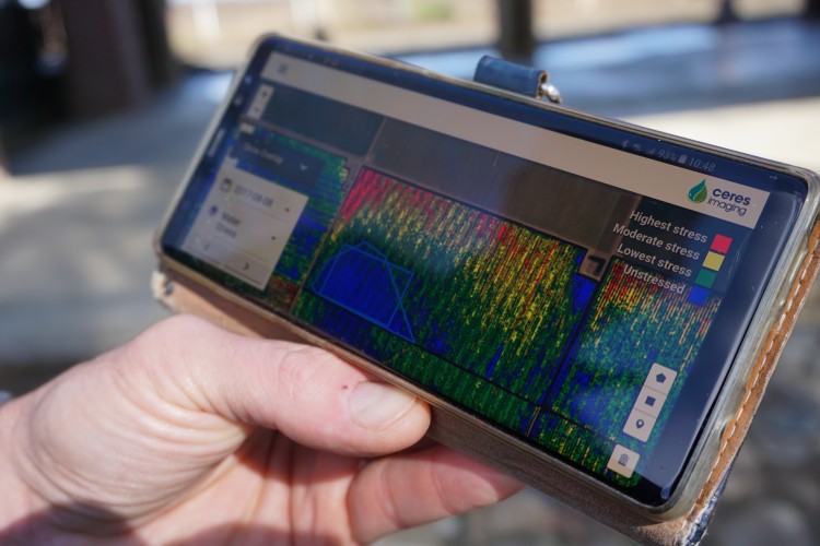
The technology can detect these issues before they affect your crop uniformity:
- early signs of heat stress
- disease pressure and nutrient deficiencies
- overwatering and underwatering
- clogs, leaks and pressure failures in irrigation systems.
The analytics tools quantify and track crop progress to inform on-farm investments and resource efficiency. This includes matching irrigation systems to your terrain and soil conditions.
How it works
Fixed-wing aircraft are flown over the property at a low altitude, taking more accurate, higher resolution images than satellite-based services. Flyover frequency starts at once per month and can be increased according to need.
Issues are detected up to 3 weeks before they become visible to the naked eye. Data models for interpreting imagery are crop-specific and can diagnose crop health at the plant level, including stress and productivity forecasts.
Ceres Imaging also provides monitoring and support to reach sustainability goals.
It integrates with third-party farm management software and the dashboard can be viewed via mobile device.
Installation and power
No installation required.
Pricing model
Annual subscription, priced per hectare.
See it in action
To view Ceres Imaging, contact the AgTech Extension Officer at Loxton demonstration farm.
Access our historic data from Loxton through the Ceres Imaging dashboard:
- username: pirsa.agtech@sa.gov.au
- password: pirsa_2020
Loxton AgTech field day demonstration
Contact vendor
Ian Lowles – Ceres Imaging
Email: ian.lowles@ceresimaging.net
Phone: 0414 671 513